Annex C
The Effect of the Scheme on
the
Pembroke Dock Conservation Area
(Should consent be given for the burial, demolition and destruction of listed monuments within the western dockyard.)
Planning Application: 20/0732/PA (Outline)
I object to the application.
Diagrams compiled using Sketchup, Google earth, Map
Maker 4 and various open-source data Files.
Diagram 1 – Map showing
listed buildings in the dockyard marked with a blue star. Super slip is pink,
fabrication sheds over buried monuments are pale blue.

The images below focus on the visual impact of
the large sheds. However, the more important
issue is that to build these
huge structures, the applicant is seeking to demolish, bury and alter a very
large number of listed and unlisted historical structures that are a unique
assemblage of monuments that give testimony to the birth of Pembroke Dock and
the industry that supported it for over one hundred years.
This is
particularly deplorable when alternative sites are available. This would avoid
the wholesale destructive damage to the core heritage site within the Pembroke
Dock Conservation Area that could be used for alternative, more sustainable
forms of employment. The western dockyard could also become a developing centre
for education, training and leisure activities that use new, sustainable
technologies to tell an exciting tale about the only Royal Naval Dockyard in
Wales.
Diagram 1A – The green markers show the location from which some of the following visualisations were taken.

Diagram 2 – An overview of the Dockyard showing important features subject to this Planning Application

Diagram 3 – Looking ESE
appx – Notice size of SW Gun Tower relative to the new sheds.

Diagram 4 – Note the
size of Paterchurch in front of the large shed A.
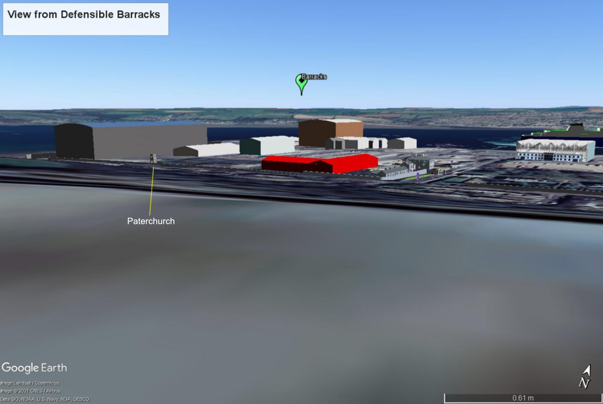
Diagram 5 – simulates the view from the footpath

Diagram 6 – Notice the size of the grey Oakum Store, right of centre. It is nearer the camera than either of the big new sheds.

Diagram 7 – Taken from the Defensible Barracks. This shows the immense height of Shed B which the application says will be built over the buried Graving Dock (Listed Grade II*).


Diagram 11– The Commodore from the ENE. Notice proximity of the grey fabrication shed (shown in red in Diagrams 4 and 12) which totally obscures the view west from The Commodore and drastically affects the setting of this Grade II* building. Notice the lurking mass of Shed A in the distance. Street view image for comparison.


Diagram 12 – The Commodore from the SE. Notice how the red Shed C crowds in on this Grade II* building. Also notice Paterchurch and how its setting and view to the west is dominated by the large Shed A.

No comments:
Post a Comment
If you can add to the information in any of my blog postings, or have a question, please write a comment, or use the contact form I will endeavour to respond as soon as I can.